

Zempoala Archeological Park
Zempoala, the place of Twenty Waters
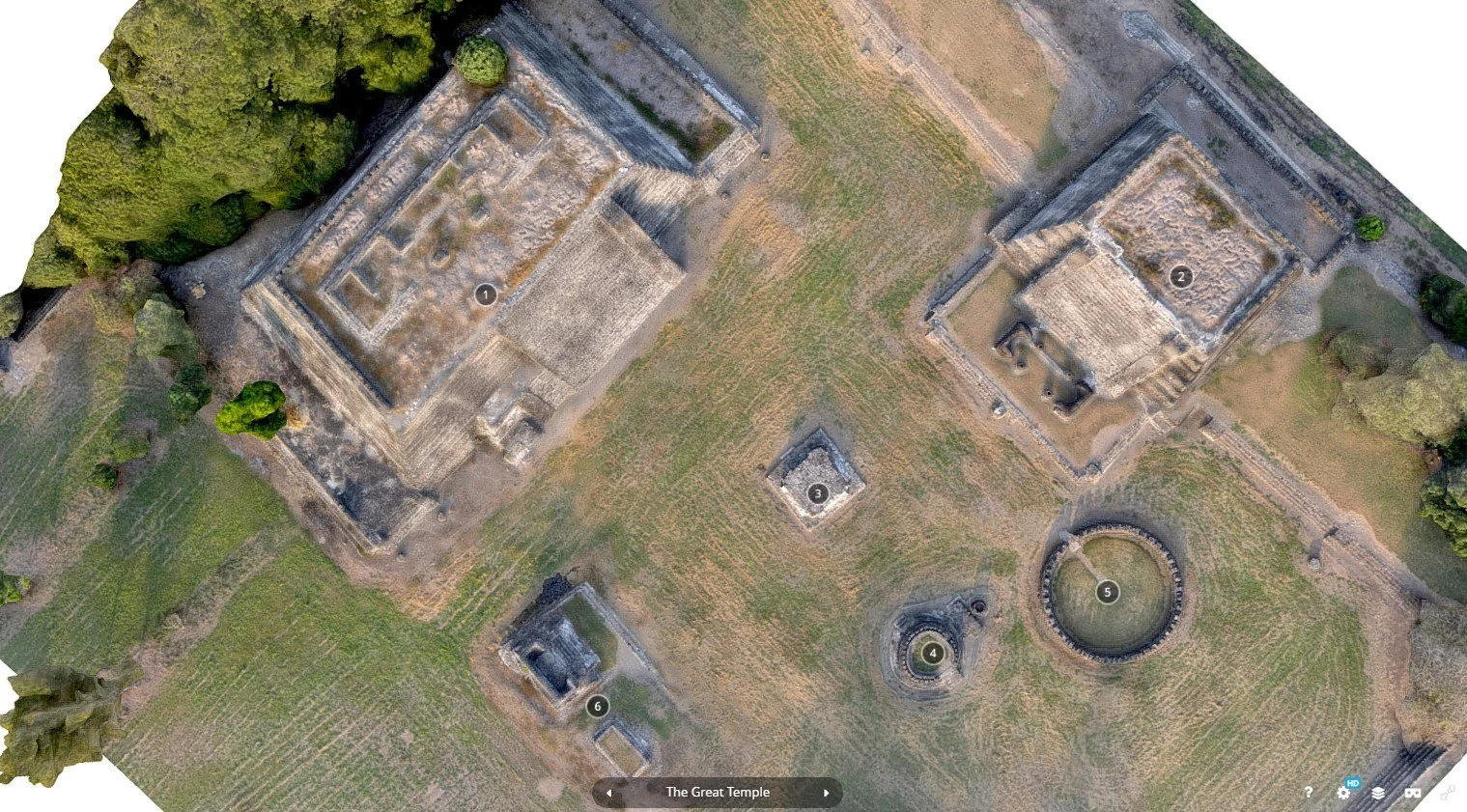
Hidden amidst the lush landscapes of Veracruz, Cempoala—also known as Zempoala, from the Nahuatl word Cēmpoalātl meaning “Place of Twenty Waters”—is a captivating archaeological site that holds the key to a rich Mesoamerican history. Nestled in the municipality of Úrsulo Galván, Cempoala was a thriving hub for the Totonacs, Chinantecas, and Zapotecs, and it stood as the heart of the Totonacapan kingdom during the postclassical period.


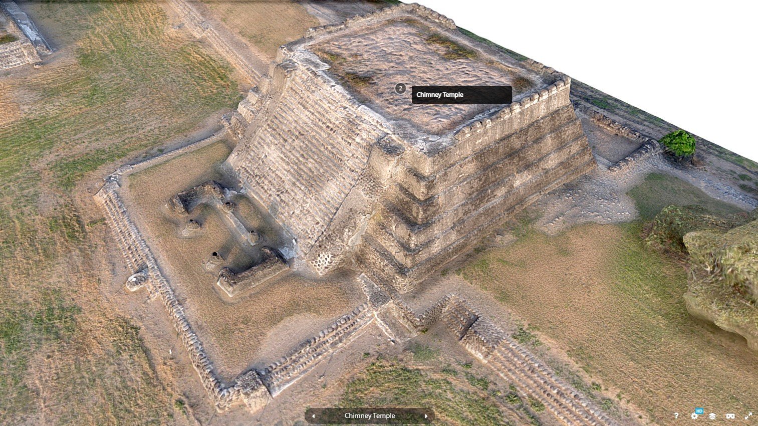


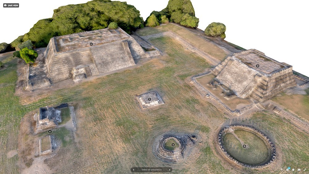
Situated just a kilometer from the Actopan River and only six kilometers from the coastline, this once-flourishing city offers a glimpse into a civilization that once dominated the region. Its significance is undeniable—Cempoala was the first urban settlement the Spanish encountered when they set foot on the American continent, marking a pivotal moment in history. With its towering ruins and whispers of ancient life, Cempoala is more than a site; it’s an invitation to explore the wonders of a civilization long past, waiting to reveal its secrets.
Interactive 3D
Archaeological 3D scanning process
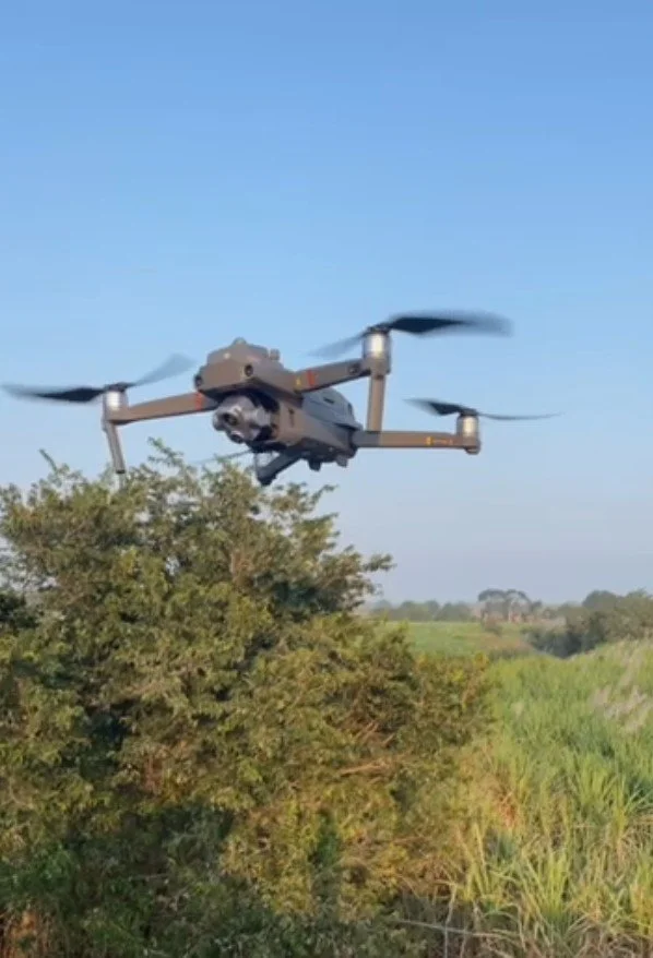
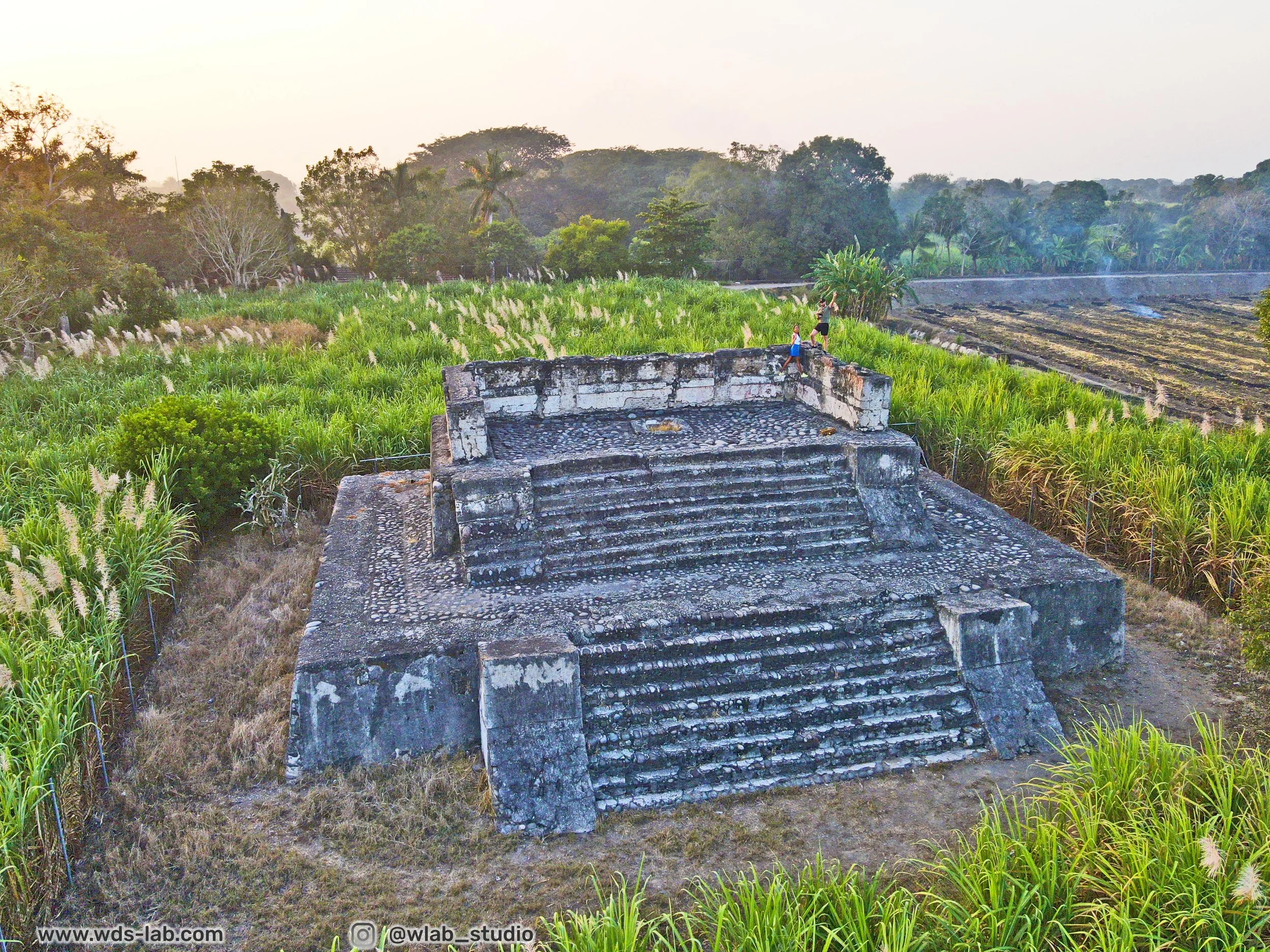
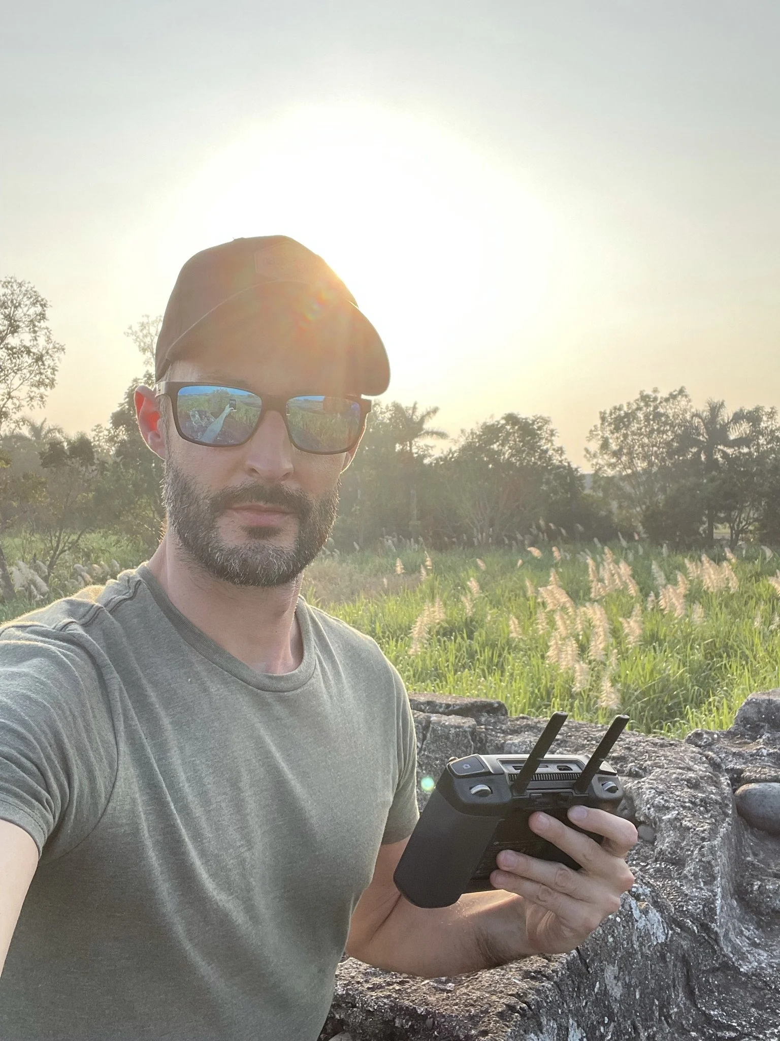
In a breathtaking fusion of technology and history, we took to the skies with the powerful Mavic 2 Enterprise drone to scan Zempoala Piramids perched on a rugged mountain. With a carefully planned oblique flight mission, this incredible drone covered the entire location in just 5 minutes, capturing every intricate detail
Using Agisoft Metashape software, we processed the data, meticulously shaping the 3D mesh with precision. The result was a stunning, model—free from the complex processes of decimation or low-res textures. The software then applied a sharp, high-resolution JPEG texture, perfect for immersive 3D exploration on platforms like Sketchfab.
This daring aerial journey brought the pyramids timeless architecture to life, offering a fresh perspective on a centuries-old landmark, now forever preserved in stunning virtual detail.